


Ninth cyclone bulletin for Mauritius issued at 0110 hours on Wednesday 02 February 2022
Ninth cyclone bulletin: A cyclone warning class III is in force in Mauritius
Total Views :
3256

Active cloud bands associated with intense tropical cyclone Batsirai are crossing the island with widespread rain and gusts of over 90 km/h in some places. The highest gust recorded is 119 km/h at Domaine les Pailles.
The estimated central pressure of Batsirai is around 950 hPa with wind gusts of about 230 km/h near the centre .
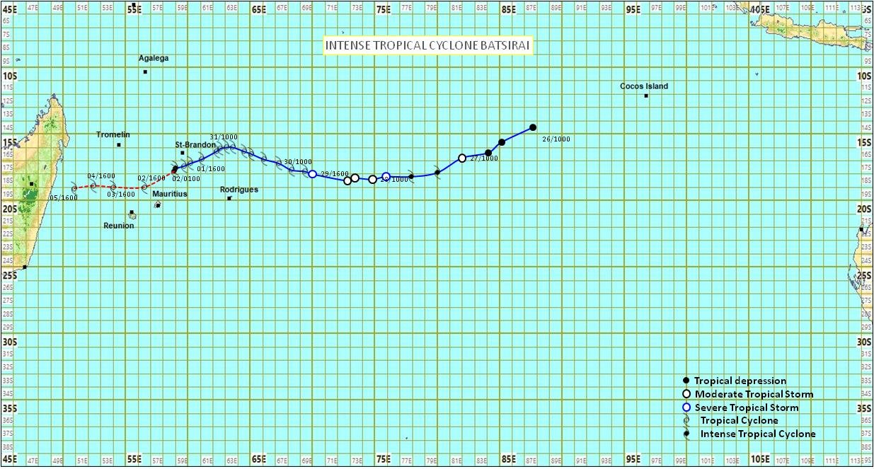
At 0100 hours, intense tropical cyclone Batsirai was centred at about 265 km to the north-north-east of Mauritius, in latitude 17.8 degrees south and longitude 58.9 degrees east. It is moving in a direction between the south-west and the west-south-west direction at about 18 km/h.
On this trajectory, intense tropical cyclone Batsirai is approaching Mauritius and constitutes a direct threat to the island. Since Batsirai is of small diameter, the maximum wind is confined within 30 km radius of the centre. Any further recurvature of the trajectory towards the south will bring the centre even closer to Mauritius increasing the risk of having cyclonic conditions over the island.
A cyclone warning class III is in force in Mauritius
The public in Mauritius is advised to complete all precautions.
The weather will be cloudy to overcast with wisdespread intermittent rain. Weather will continue to deteriorate in the coming hours with more frequent moderate showers, thundery at times, and stronger gusts.
Wind will blow from the south-east at a speed of about 50 km/h with gusts of the order of 100 km/h strenghtening gradually in the coming hours. The wind gusts are likely to exceed 120 km/h in the morning.
The sea will be high with swells of 7 metres. The public is advised not to venture at sea.
A cyclone warning class III is in force in Mauritius
A cyclone warning class III is in force in Mauritius
The next bulletin will be issued at around 0410 hours this morning.